| 2023/2024 | Small TLEF | Douglas Pulleyblank | Arts | Audible phonology | Year 1 | 5674 | Active | | | | | | | | | | | | | | |
| 2023/2024 | Small TLEF | Catherine Corrigall-Brown | Arts | Sociology Multi-modality Project | Year 1 | 41363 | Active | | 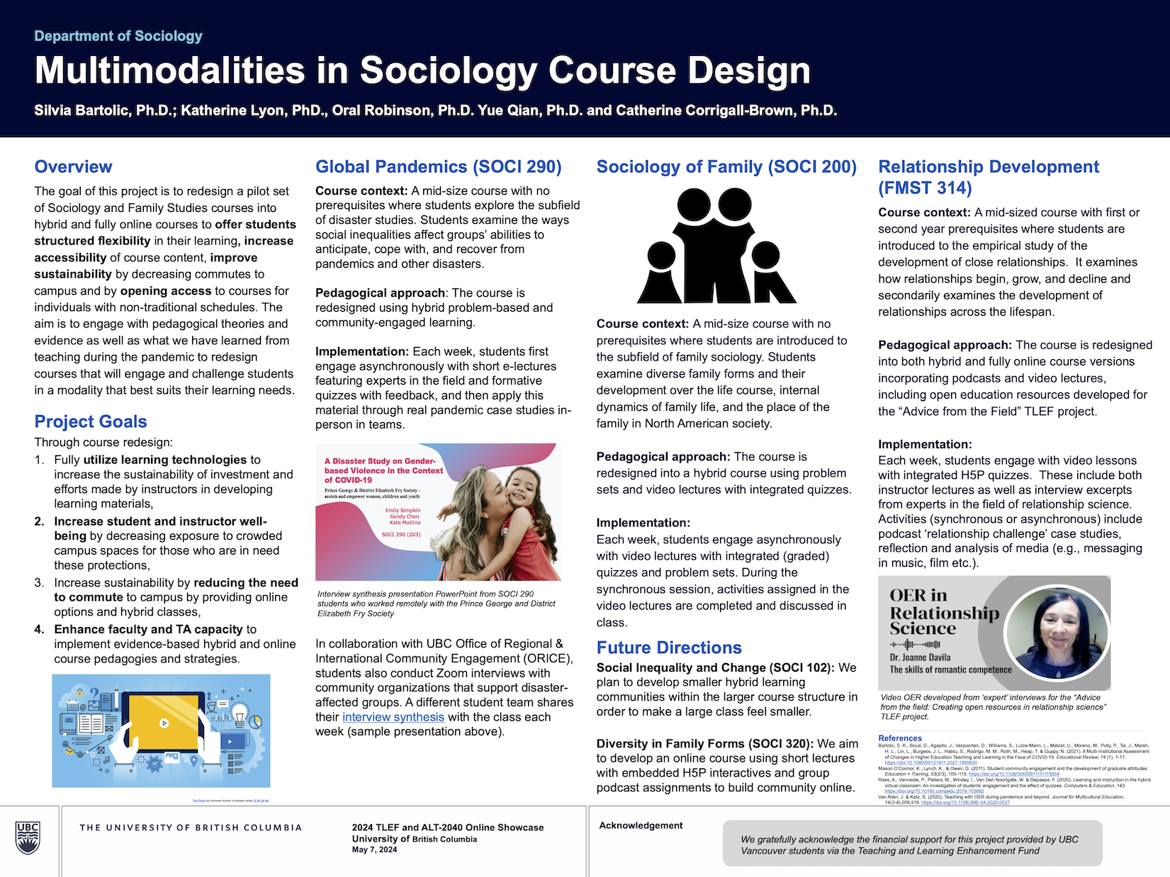 | 2024/2025 | Small TLEF | Catherine Corrigall-Brown | Year 2 | 8453 | | | | | | | |
| 2023/2024 | Small TLEF | Michelle Stack | Education | Partnering with the Downtown Eastside to Shift Journalism Education | Year 1 | 49545 | Active | | 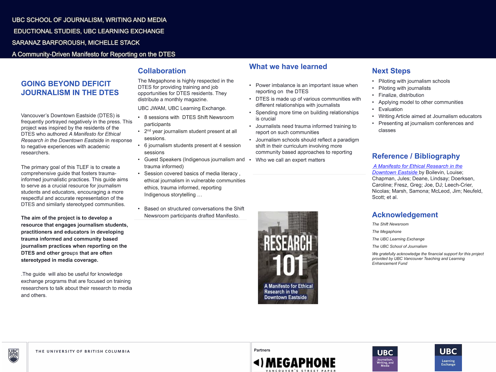 | | | | | | | | | | | | |
| 2023/2024 | Small TLEF | Patrick Culbert | Forestry | Virtual Field Trips to Interior Forests | Year 1 | 14818 | Active | | | | | | | | | | | | | | |
| 2023/2024 | Small TLEF | James Bachmann | Allard School of Law | Online Open Access Critical Thinking Tutorial | Year 1 | 30278 | Active | | 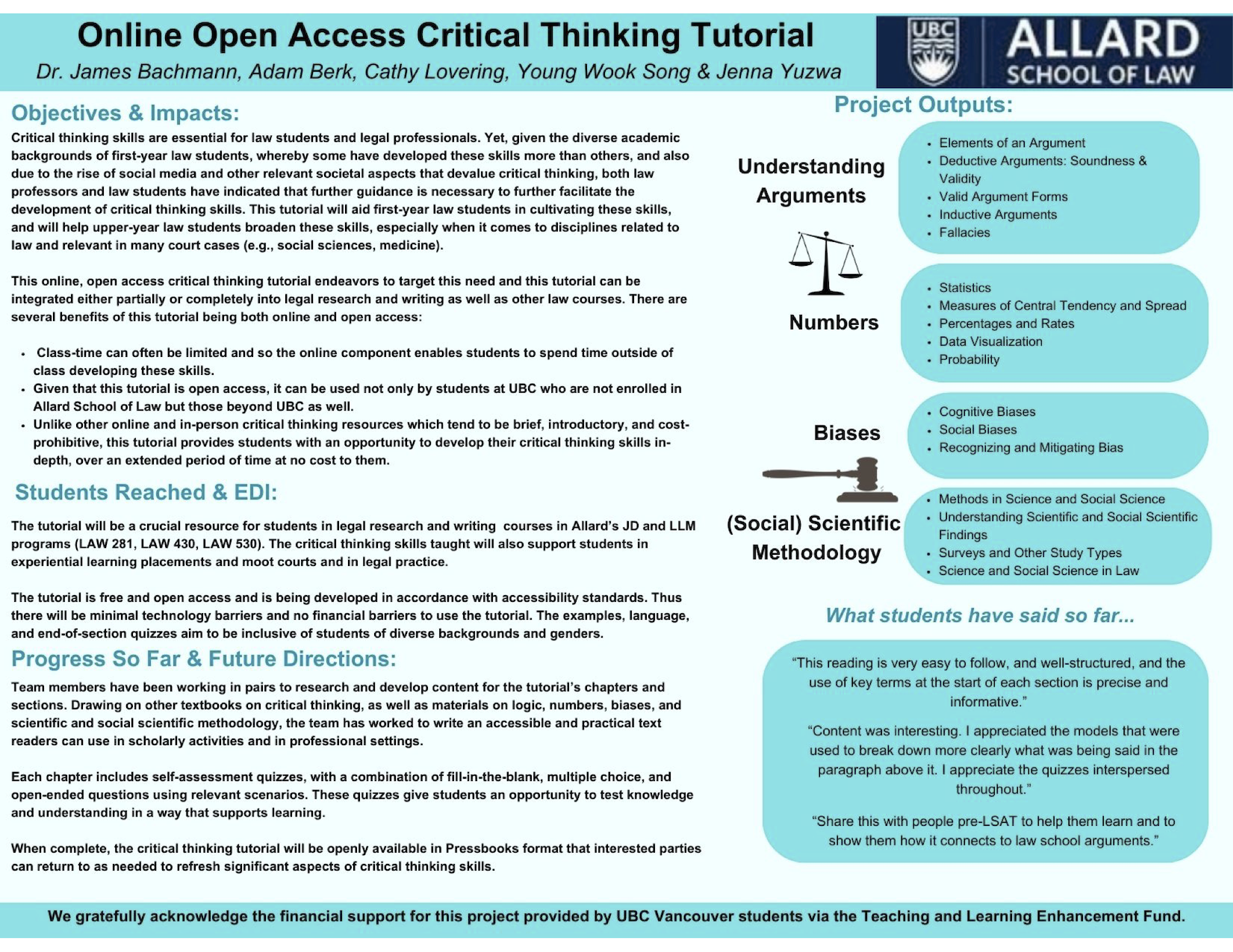 | 2024/2025 | Small TLEF | James Bachmann | Year 2 | 7722 | | | | | | | |
| 2023/2024 | Small TLEF | Samuel Beswick | Allard School of Law | Opening Up Tort Law Courses | Year 1 | 23891 | Active | | 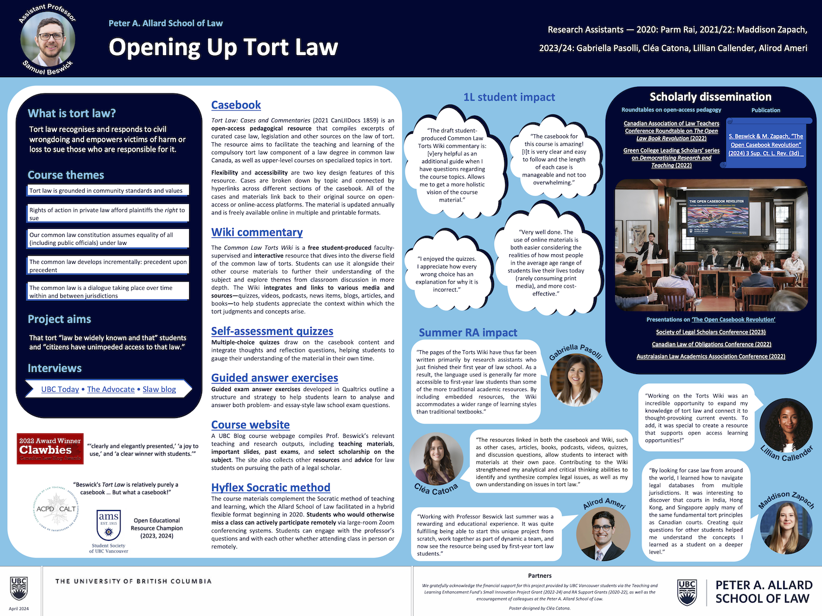 | 2024/2025 | Small TLEF | Samuel Beswick | Year 2 | 16109 | | | | | | | |
| 2023/2024 | Small TLEF | Jane Xia | Pharmaceutical Sciences | IMPPaCT Project - Implementing Pharmacy Point of Care Testing Project | Year 1 | 30000 | Active | | | 2024/2025 | Small TLEF | Jane Xia | Year 2 | 19983 | | | | | | | |
| 2023/2024 | Small TLEF | Gabriella Wong & Asal Taheri | Pharmaceutical Sciences | Remediation Program for Students Experiencing Academic Challenges during Practicum in the Entry-to-Practice PharmD Program | Year 1 | 26798 | Active | | | 2024/2025 | Small TLEF | Gabriella Wong & Asal Taheri | Year 2 | 13306 | | | | | | | |
| 2023/2024 | Small TLEF | Jose Rodriguez Nunez | Science | Chemistry and Societal Impacts: Re-imagining the First-Year Experience in the Lecture and Lab with CHEM 141 | Year 1 | 24819 | Active | | | 2024/2025 | Small TLEF | Jose Rodriguez Nunez | Year 2 | 24654 | | | | | | | |
| 2023/2024 | Small TLEF | Priya Anka Lekhi | Science | Enhancing Equity in the First-year Chemistry Laboratory through a Targeted Pre-Term Laboratory Foundations Event | Year 1 | 14379 | Active | | 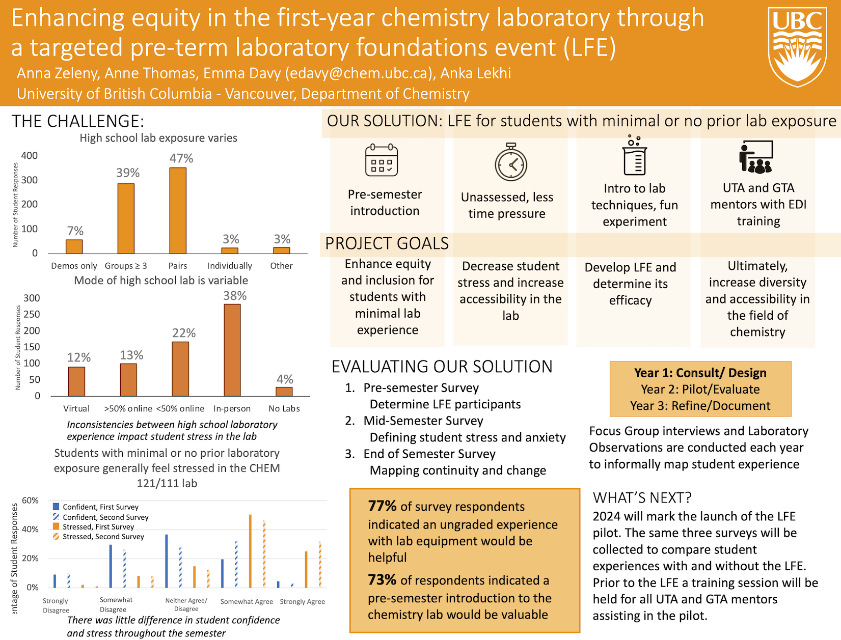 | 2024/2025 | Small TLEF | Priya Anka Lekhi | Year 2 | 11298 | | | | | | | |
| 2023/2024 | Small TLEF | Joss Ives | Science | Expanding Course Insights for Equity and Inclusion in Science | Year 1 | 18928 | Active | | | 2024/2025 | Small TLEF | Joss Ives | Year 2 | 15536 | | | | | | | |
| 2023/2024 | Small TLEF | Jackie Chambers & Bridgette Clarkston | Science | MAKING CONNECTIONS: Students, faculty, staff, and community partners as co-creators of a biodiversity science course for undergraduates | Year 1 | 24318 | Active | | 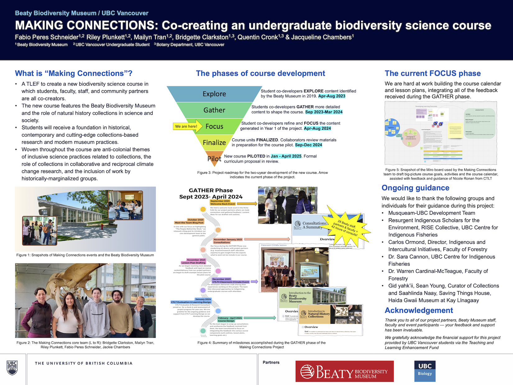 | 2024/2025 | Small TLEF | Jackie Chambers & Bridgette Clarkston | Year 2 | 24318 | | | | | | | |
| 2023/2024 | Small TLEF | Sven Bachmann | Science | Math and EOAS Collaborate to Improve Climate Education at UBC | Year 1 | 27893 | Active | | | 2024/2025 | Small TLEF | Sven Bachmann | Year 2 | 18699 | | | | | | | |
| 2023/2024 | Small TLEF | Rana Tarzemany | Dentistry | Development of Novel Surgical Simulation Technology to Enhance Education of Dental Students and Surgical Residents at the UBC Faculty of Dentistry | Year 1 | 28175 | Active | | | | | | | | | | | | | | |
| 2023/2024 | Small TLEF | Ronaldo Cerri | Land & Food Systems | Creating a hybrid, interactive and enhanced learning experience for students in animal health and physiology courses | Year 1 | 40000 | Active | | | 2024/2025 | Small TLEF | Ronaldo Cerri | Year 2 | 10000 | | | | | | | |
| 2024/2025 | Large TLEF | Laurie McNeill & Andrew Owen | Arts | We’re only Human? Educative Frameworks for Artificial Intelligence, Academic Integrity, and Writing in in the Faculty of Arts | Year 1 | 69861 | Active | | | | | | | | | | | | | | |
| 2024/2025 | Large TLEF | Justin Bull | Sauder School of Business | Integrating SDG-Related Content into Business Curriculum to Develop Future Responsible Leaders | Year 1 | 42689 | Active | | | | | | | | | | | | | | |
| 2024/2025 | Large TLEF | Tara Ivanochko | Science | Implementing the Environmental Science (ENSC) Curriculum Renewal | Year 1 | 74048 | Active | | | | | | | | | | | | | | |
| 2024/2025 | Large TLEF | Dongwook Yoon | Science | Preparing for an Automated Future: Building Automation Resilience in Computer and Data Science Education | Year 1 | 63250 | Active | | | | | | | | | | | | | | |
| 2024/2025 | Small TLEF | Sathish Gopalakrishnan | Applied Science | CPSLab: Design and Analysis of Cyber-Physical Systems using a Safety-First Approach | Year 1 | 46628 | Active | | | | | | | | | | | | | | |
| 2024/2025 | Small TLEF | Andrew Binet | Applied Science | Developing a Community-Engaged Capstone Onboarding Model for Urban Studies | Year 1 | 16978 | Active | | | | | | | | | | | | | | |
| 2024/2025 | Small TLEF | Jonathan Nakane | Applied Science | Development of a new case study incorporating themes of Indigenous engagement and consultation in a core first year engineering course | Year 1 | 29999 | Active | | | | | | | | | | | | | | |
| 2024/2025 | Small TLEF | Sergey Kravchenko | Applied Science | Integration of Simulation Software Teaching Modules into Materials and Manufacturing Engineering Curricula to Enhance Practical Learning | Year 1 | 50000 | Active | | | | | | | | | | | | | | |
| 2024/2025 | Small TLEF | Siobhán Wittig McPhee | Arts | Building and assessing the use of audio artifacts in blended gegoraphy courses | Year 1 | 5000 | Active | | | | | | | | | | | | | | |
| 2024/2025 | Small TLEF | David Gaertner | Arts | City Poems: Transformative Learning through Locative Poetry | Year 1 | 49254 | Active | | | | | | | | | | | | | | |
| 2024/2025 | Small TLEF | Szu Shen | Arts | Community as Pedagogy: Building Sustainability for Community Engaged Research | Year 1 | 25000 | Active | | | | | | | | | | | | | | |
| 2024/2025 | Small TLEF | Lillian May | Arts | Creation of a Canvas Module: “What Science Can Tell You About How To Be Successful in University” | Year 1 | 12165 | Active | | | | | | | | | | | | | | |
| 2024/2025 | Small TLEF | Laila Ferreira | Arts | Cultivating Inclusive Writing Instruction: Planting Seeds Across the Curriculum | Year 1 | 21309 | Active | | | | | | | | | | | | | | |
| 2024/2025 | Small TLEF | Evan Mauro & Kirby Manià | Arts | Learning Research, Learning Reciprocity: Student Community Engagement with the Making Research Accessible Initiative | Year 1 | 25000 | Active | | | | | | | | | | | | | | |
| 2024/2025 | Small TLEF | Isabelle Delage-Béland | Arts | Modernizing traditional French grammar courses: Towards an active, descriptive, and inclusive approach for advanced students | Year 1 | 16250 | Active | | | | | | | | | | | | | | |
| 2024/2025 | Small TLEF | Nick Hall | Arts | Transforming Language Learning: Inclusive Interactive Web-Based Course Materials for Studying Elementary Japanese | Year 1 | 33943 | Active | | | | | | | | | | | | | | |
| 2024/2025 | Small TLEF | Jolanta Aleksejuniene | Dentistry | Decision Making and Critical Thinking in the Undergraduate Dental Curricula | Year 1 | 40761 | Active | | | | | | | | | | | | | | |
| 2024/2025 | Small TLEF | Teresa Dobson | Education | Ethical and Professional Use of Generative AI in Teaching and Learning | Year 1 | 26591 | Active | | | | | | | | | | | | | | |
| 2024/2025 | Small TLEF | Carolyn McEwen | Education | Improving student learning and experience through curriculum mapping | Year 1 | 32840 | Active | | | | | | | | | | | | | | |
| 2024/2025 | Small TLEF | Kari Grain | Education | Reimagining Experiential Education: Pedagogies and Field Experiences | Year 1 | 25000 | Active | | | | | | | | | | | | | | |
| 2024/2025 | Small TLEF | Jasmin Ma | Education | UBC School of Kinesiology: Implementation of a Clinical Exercise Physiologist Pathway | Year 1 | 24895 | Active | | | | | | | | | | | | | | |
| 2024/2025 | Small TLEF | Andrew Almas | Forestry | Creating an Urban Forest Demonstration at the Malcolm Knapp Research Forest Arboretum | Year 1 | 47791 | Active | | | | | | | | | | | | | | |
| 2024/2025 | Small TLEF | Bianca Eskelson | Forestry | FVS-BC Exercises for Forest Resources Management and Conservation | Year 1 | 26692 | Active | | | | | | | | | | | | | | |
| 2024/2025 | Small TLEF | Nicholas Coops | Forestry | Geospatial Solutions for the Climate Emergency: Advancing Earth Observation, Geographic Information Systems and Remote Sensing Education | Year 1 | 48720 | Active | | | | | | | | | | | | | | |
| 2024/2025 | Small TLEF | Michelle Zeng | Forestry | Innovating Forestry Education: Advancing Accessibility, Equity, Diversity, and Inclusion | Year 1 | 37135 | Active | | | | | | | | | | | | | | |
| 2024/2025 | Small TLEF | Michael Johnson | Land & Food Systems | LFS 252 Hybrid Delivery Project | Year 1 | 23660 | Active | | | | | | | | | | | | | | |
| 2024/2025 | Small TLEF | Philip D. Crowell | Medicine | Dental Ethics and DEI: Toward a Strategic Plan to Align Clinical Ethics with the Competencies of DEI | Year 1 | 27521 | Active | | | | | | | | | | | | | | |
| 2024/2025 | Small TLEF | Sarah Purcell | Medicine | Development, refinement, and evaluation of educational modules for identifying and managing eating disorders among students enrolled in healthcare-related programs | Year 1 | 29327 | Active | | | | | | | | | | | | | | |
| 2024/2025 | Small TLEF | Ben Mortenson | Medicine | Integrating and Enhancing Occupational Therapy Programs Climate and Sustainability Education | Year 1 | 25000 | Active | | | | | | | | | | | | | | |
| 2024/2025 | Small TLEF | Heather Buckley | Medicine | Layered Learning: Building critical community capacity for teaching medical students | Year 1 | 49934 | Active | | | | | | | | | | | | | | |
| 2024/2025 | Small TLEF | Hannah Wittman | Science | Ethical Engagement for Climate and Environmental Justice | Year 1 | 24530 | Active | | | | | | | | | | | | | | |
| 2024/2025 | Small TLEF | Steven Wolfman | Science | Redesigning computer-based labs to be more engaging by identifying and implementing use cases relevant to students | Year 1 | 7048 | Active | | | | | | | | | | | | | | |
| 2024/2025 | Small TLEF | Firas Moosvi | Science | Sustainable migration to digital assessments at scale | Year 1 | 30000 | Active | | | | | | | | | | | | | | |
| 2024/2025 | Small TLEF | Jacquelyn Cragg | Pharmaceutical Sciences | Statistics Bakers: a Recipe Box for Biostatistics and Critical Appraisal Courses at The University of British Columbia | Year 1 | 38716 | Active | | | | | | | | | | | | | | |
| 2024/2025 | Small TLEF | Larry Leung | Pharmaceutical Sciences | The BRAIN Project - Building Resources and Accessibility in Neurology for Practical Learning | Year 1 | 30000 | Active | | | | | | | | | | | | | | |
| 1998/1999 | Small TLEF | Ann Doyle | First Nations House of Learning | First Nations Information Technology (IT) and Research Skills | Year 1 | | Completed | | | 1999/2000 | Small TLEF | Ann Doyle | Year 2 | 25328 | | 2000/2001 | Small TLEF | Jo-Ann Archibald | Year 3 | 23000 | |
| 1997/1998 | Small TLEF | J. P. Kimmins | Forestry | Forestry 202 - Forest Ecology Learning Enhancement Tool | Year 1 | | Completed | | | 2000/2001 | Small TLEF | J. P. Kimmins | Year 2 | 11125 | | | | | | | |
| 1998/1999 | Small TLEF | Ross King | Arts | Multimedia Web-Based Teaching Material for Korean as a Foreign Language | Year 1 | 41520 | Completed | | | 1999/2000 | Small TLEF | Ross King | Year 2 | 15000 | | 2000/2001 | Small TLEF | Ross King | Year 3 | 15000 | |
| 1997/1998 | Small TLEF | Ed Auld | Arts | A Hot-linked CD-ROM Version of the British Open University’s Self Study Package “The Flexible Learning Approach to Physics (FLAP)” | Year 1 | | Completed | | | 1999/2000 | Small TLEF | Ed Auld | Year 2 | 10000 | | | | | | | |
| 1998/1999 | Small TLEF | Jülyet Benbasat | Science | Design and Implementation of Integrated Science Core Courses | Year 1 | 30935 | Completed | | | 1999/2000 | Small TLEF | John Gosline | Year 2 | 49750 | | | | | | | |
| 1997/1998 | Small TLEF | William Schreiber | UBC Health | Using WebCT (Course Tools) as an Adjunct to the delivery of Phase II Courses in the Faculties of Medicine and Dentistry Curriculum | Year 1 | | Completed | | | 1998/1999 | Small TLEF | Marc Broudo | Year 2 | | | 1999/2000 | Small TLEF | Marc Broudo | Year 3 | 39700 | |